Home Blog Page 25

10 Foods That Are Bad For The Environment

0

When it comes to climate change, we often think of the cars we drive and the energy we use in our homes and offices as the main culprits. When you eat burgers or salmon, we don’t always see the environmental impact of these foods on the planet.

However, the bad news is that agriculture has a huge impact on the production of greenhouse gases. In fact, according to the Food and Agriculture Organization of the United Nations, greenhouse gases produced by agriculture are currently increasing. When it comes to food production, not all products are created equal. The following foods should be avoided by anyone looking to reduce their carbon footprint.

10. Almond milk

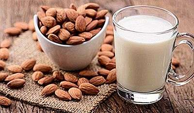
Almond milk is one of the most sought after alternative dairy products. However, for all of its health benefits, its impact on the environment has been heavy. Over 80% of the world’s almonds come from California, which recently experienced a terrible drought. Each plant requires about five liters of water to develop. In addition, 100 liters of water are also required to produce 100 ml of almond milk. This creates a high demand for water, forcing farmers to drill wells, which are known to affect bridges, roads, irrigation canals and trigger earthquakes whose effects are damaging to the environment.

9. Beef

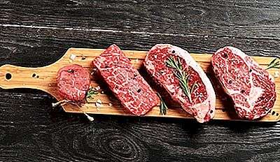
Animal agriculture contributes around 14.5% of the world’s greenhouse gases, 65% of which comes from beef and dairy cows. The Natural Resources Defense Council of the United States estimates that each kilogram of beef produced emits about 27 kg of carbon dioxide. By adding the amount of beef consumed per day around the world, this means that beef has a considerable carbon footprint. In addition, cows produce methane, which is classified as a harmful greenhouse gas. In many countries, deforestation is huge in order to clear the land for more livestock, which reduces the use of greenhouse gases that have caused climate change.

8. lamb

Lamb, like cattle in agriculture, contributes to climate change with each kg of lamb meat contributing to carbon emissions 22.9. The production of red meat requires a lot of resources because it requires a large amount of animal feed (mainly corn and soybeans). Synthetic fertilizers and manure used to grow corn and soybeans emit nitrous oxide, a climate pollutant that is 298 times more powerful than carbon dioxide.

7. Cheese

Cheese is also known as a major contributor to carbon dioxide. First of all, it comes from cows that emit methane. Second, refrigerate and transport. Only part of the cheese on the market is imported, but it contributes to half of carbon emissions. Cheese production consumes a lot of energy due to the many processes involved in separating raw milk from low-fat cream, which is then pasteurized, cooled, matured and churned. In addition, refrigeration and transport of cheese are also very energy-consuming, requiring more energy, which is harmful to the environment.

6. Rice

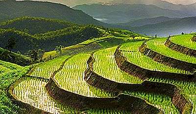
Rice fields are the main source of methane on earth. As the second most commonly produced and demanded staple in the world, rice production is largely responsible for the rising temperatures caused by methane. The microorganisms that produce carbon monoxide produce methane in the rice fields. Increased carbon dioxide levels boost rice yields, but increase methane emissions to some extent. As a result, the amount of methane produced per kilogram of rice will increase, which will cause temperatures near the rice fields to rise. Global demand for rice is increasing, which, combined with a growing world population, means that the amount of methane emissions from growing rice will increase over time.

5. white bread

We all know that whole grain bread and wheat bread are healthier than white bread. The production of white bread requires the pure refining of wheat flour through a series of alteration processes which consume a lot of energy. The processes require intensive refining which consumes more energy resources and has a greater negative impact on the planet. Pollution from plastic packaging is also a growing concern.

4 eggs

The production of an egg uses approximately 4.8 kg of carbon dioxide. Most of the emissions associated with eggs come from the production of chicken feed, energy consumption on the farm, nitrous oxide gas produced by poultry litter, and the burning of fuel during cooking. In addition, the increase in the number of cage houses for chicken leads to an increase in the production of ammonia, in particular from manure.

3. Tuna

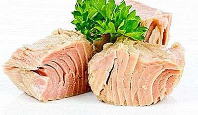
Tuna has long been the victim of overfishing in waters around the world. Fishing and consuming endangered tuna species only accelerates the extinction of ocean species. The methods used by large commercial fishing vessels to catch tuna threaten their numbers, resulting in the death of countless species and other types of marine life trapped in fishing vessels.

2. Salmon

Salmon is rich in omega 3, highly recommended by health experts. However, salmon farming is one of the most destructive aquaculture systems. Aquaculture practices require the use of open mesh cages directly discharged into the ocean, waste from farms, chemicals and disease-causing parasites are discharged directly into ocean waters, threatening other marine species. In addition, the practice has resulted in the depletion of wild fish stocks due to the high protein content necessary for salmon

1. chicken

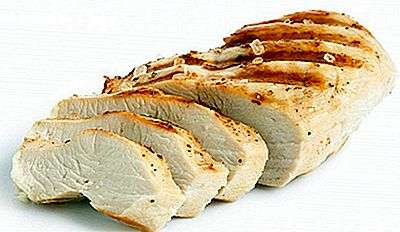
You are not doing the environment justice by eating chicken. Poultry farming is a major cause of environmental degradation in the United States. First, the 10 billion birds are slaughtered each year in the United States, resulting in environmental pollution from carcasses. Thousands of birds are overcrowded in exceptionally small areas, resulting in a dirty, unpleasant and disease-infested environment due to the harmful confinement of living creatures in small spaces.

The Geography Of Rome

0

5. Where is Rome located? –

The historic city of Rome is located in the west-central part of the Italian peninsula, on the banks of the Tiber, in the Lazio region of Italy. The city is the capital of Italy and also its largest and most populous metropolis, welcoming millions of inhabitants 2.9 in an area of ​​1,285 km2. The Vatican City, a country, is located within Rome, making it the only example of a country in a city.

4. Climate of Rome –

The Mediterranean climate prevails in Rome, characterized by hot, dry summers and cold, wet winters. During the hottest months of July and August, the average daytime temperature is 30 ° C while at night it is 18 ° C. In the coldest winter month of winter, the daytime average temperature is 12 ° C and the nighttime temperature is 3 ° C. Heavy snowfall is extremely rare, but light snowfall occurs almost every winter. However, it is rare for snow accumulation on the ground to occur frequently. The pleasant climate of Rome favors a strong tourist frequentation in the city throughout the year.

3. The Tiber Of Rome –

The Tiber is a historic river in Europe, famous for the city of Rome located on its banks. The Tiber is the second longest river in the country after the Po river. The river originates from the slope of Monte Fumaiolo from where it flows for km 405 in a generally south direction and empties into the Tyrrhenian Sea near Ostia Antica. According to some ancient authors, the Tiber was originally known as the Albula, but it was renamed Tiberis after a king of Alba Longa, King Tiberius, died by drowning in the river. The river played a vital role in the birth and expansion of the city of Rome, as will be explained in the sections below. Another river, the Aniene, also flows through Rome. The river joins the Tiber north of the historic center of the city.

2. Geography of ancient Rome and origin of Roman civilization –

Historians believe that Rome was founded on a group of seven hills located in the present region of Lazio in Italy. These hills, named Aventine, Caelian, Capitoline, Esquiline, Palatine, Quirinal and Viminal, are located on the eastern bank of the Tiber, in the heart of the city of Rome. Small village-style settlements are said to have grown on the peaks of these seven hills, but at first these settlements were neither organized nor unified into a single entity. The city was probably founded by Romulus on the Palatine Hill and, little by little, the inhabitants of the seven hills came together to share common interests and solve common problems, thus giving shape to the ancient city of Rome. Thus, the aggregation of these agglomerations paved the way for the transformation of a proto-urban scene in an urban situation. The increase in agricultural productivity and the intensification of commercial activities probably stimulated the growth of the city.

1. How did the geography of Rome affect its expansion? –

The geography of a place often plays a big role in the growth of establishments in the place. This fact is no different for Rome where the geography of Rome had a major impact on its expansion. The city’s elevated location at the top of the seven hills provided residents with a sense of protection and also protected people from flooding. All the major cities of the world developed on the banks of the great rivers, just like Rome. The waters of the Tiber met the water needs of the people of the region. The river also facilitated irrigation and navigation. It linked Rome to the Mediterranean Sea and thus provided an easy trade route between Rome and other parts of Europe and the world.

The Most Expensive Cities In The World To Buy Luxury Homes

0

Luxury homes make some people dream. These homes are known to be in the best location that a city has to offer. Only the highest quality materials are used to finish luxury homes and no detail is left out. A luxury home can include amenities such as a spa, games room, movie theater, or indoor pool, and maintaining the resident’s privacy is of the utmost importance in its design. Such features come at a high price, and in some places the price is higher than in others.

This article takes a closer look at the 10 most expensive cities in the world for buying luxury homes, according to the Prime Global Citizen Index for 2017. This index compares the cost of luxury homes in 41 cities, as well as the price increases over periods 3, 6 and 12. For reference, the increase in the average price between June 2016 and June 2017 was 4.4%.

1 Melbourne, Australia

Melbourne, Australia is the most expensive city in the world for luxury homes. This urban area, the second most populous, is also known to have one of the highest costs of living in the country. According to statistics, the price of luxury homes does not seem to be intended to drop rapidly. For the period of 10 between December 6 and June 2016, the average cost of luxury residences increased by 2017% in Melbourne. A slightly lower increase of 4.8% was observed between March and June from 3.3. The annual average was, however, a 2017% increase.

2. Cape Town, South Africa

The most expensive city in the world for luxury homes is Cape Town, South Africa. The most expensive area in this city is Clifton, where you can find a large number of luxury homes. The average house price in Clifton is around $ X million. The cost of luxury properties in this city continues to grow, with an average annual increase of 9% between June 2.53 and June 9.2.

3. Berlin, Germany

Berlin, the capital and the most populous city in Germany, is the most expensive city for the purchase of luxury houses. We have known for a long time that this city has high property prices. In fact, the country’s most expensive luxury apartment (per square foot) was sold in Berlin in 8 at just over $ 2016 per square foot. Those looking for a luxury home in Berlin should not expect relief anytime soon. The prices of luxury houses increased in this city by 2.100% between June 9.7 and June 2016. In just 2017 between December 6 and June 2016, the increase was recorded at 2017%.

4. Madrid, Spain

Madrid, the capital of Spain and one of the most populous cities in the European Union, is the most expensive city in the world for the luxury home market. Real estate investors viewed this city as a relatively stable investment location during the recent global economic crisis and, as a result, the number of luxury homes sold increased by 7% in 25. The most expensive neighborhoods in Madrid are: Salamanca, Chamberi and Jeronimo. The high demand for these houses influenced the average purchase price, which increased in 2015 between June 10.7 and June 2016.

5. Sydney, Australia

Sydney has the largest population in Australia and is the capital of the state of New South Wales. This city is known for its high real estate prices. In fact, a simple patch of undeveloped land was considered more expensive than a completed luxury home in Brisbane. Between 2014 and 2015, prices for the entire Sydney property market increased by 13.7%, partly due to high demand and insufficient supply. This increase is no exception in the luxury market, where the average cost of housing rose 11.5% between June 2016 and June 2017.

6 Beijing, China

Beijing, the capital of China, has one of the most expensive property prices in the world, compared to average household income. This city has seen a dramatic increase in the average price of homes in the past 7 years, an astonishing feat for a place where the real estate market was previously thought to be non-existent. Between June 2016 and June 2017, the price of luxury homes in this city increased by 15%. Although this percentage is quite high, it actually represents a decrease compared to previous years, where the strongest annual growth was recorded at 22.9%.

The government and property developers have focused on reducing the construction of luxury homes in this city. In the third quarter of 2016, the city did not report any newly constructed luxury apartments. The housing supply remained unchanged during this period, indicating a possible slowdown in demand.

7 Shanghai, China

Shanghai, China is the 4 most expensive site for buying luxury homes. The trend is similar to that observed in Beijing. In other words, prices continue to rise, but at much lower percentages than in previous years. The increase in the prices of luxury real estate in this city has been greater than that of Beijing. Between June 2016 and June 2017, Shanghai experienced an increase of 19.7%.

8. Seoul, South Korea

Seoul, the capital of South Korea, takes 3rd place on this list due to the very sharp increase in prices for luxury homes. The annual average between June and June of 2016 increased at the rate of 2017%. Like other Asian cities, this percentage increase, although high, actually represents a slowdown in prices for luxury homes. This slowdown is partly explained by the fact that the city has an abundance of housing on the market and that the government has recently implemented more stringent guidelines for loans and mortgages.

9. Toronto, Canada

Toronto, Canada is the only city on this list located in North America. The prices of luxury real estate in this city increased by 20.7% between June 2016 and June 2017. Despite this above-average increase, sales of luxury homes in Toronto have not slowed. Instead, sales of luxury homes, with price tags of 4 million or more, almost doubled between January and June of 2017.

10. Guangzhou, China

The biggest increase in the price of luxury homes was reported in Guangzhou, the third most populous city in China. In this city, the cost of luxury real estate increased by a breathtaking 35.6%. Construction of these homes continues at an above average speed, with no signs of slowing down.

Attempts To Go Over Niagara Falls In The Barrel

0

Niagara Falls is a collective name given to the three waterfalls that border the national border between the Ontario province of Canada and the state of New York in the United States. The largest waterfall is Horseshoe Falls, followed by the American Falls and Bridal Veil Falls (the smallest of the three). Horseshoe Falls are entirely located in Canada, while the American falls are entirely located in the United States and separated by Goat Island. Bridal Veil Falls is also on the American side, separated from the other two waterfalls by the island of Luna. Niagara Falls is located on the Niagara River, which drains Lake Erie into Lake Ontario, then combines to form the highest flow in the world, a difference in elevation greater than that of the 50 meters. Horseshoe Falls are considered the most powerful falls in North America based on vertical height and flow. Niagara Falls is believed to have formed during the last ice age, when the water from the newly structured Great Lakes made its way through the Niagara Escarpment en route to the Atlantic Ocean. Although Niagara Falls is not extraordinarily high, it is very wide. Niagara Falls is famous not only for its breathtaking scenery, but also for its precious source of hydroelectric power. when the water from the newly structured Great Lakes made its way across the Niagara Escarpment en route to the Atlantic Ocean. Although Niagara Falls is not extraordinarily high, it is very wide. Niagara Falls is famous not only for its breathtaking scenery, but also for its precious source of hydroelectric power. when the water from the newly structured Great Lakes made its way across the Niagara Escarpment en route to the Atlantic Ocean. Although Niagara Falls is not extraordinarily high, it is very wide. Niagara Falls is famous not only for its breathtaking scenery, but also for its precious source of hydroelectric power.

The wonders of Niagara Falls

For hundreds of years, many people have traveled the world to visit and experience the spectacle of Niagara Falls. Horseshoe Falls on the Canadian side cover 2,600 feet (792 m) wide, while American Falls cover 1,060 feet (323 m) wide. The highest vertical fall is on the horseshoe covering the feet 173 (53 m). Niagara Falls has an average flow of 4 million cubic feet (110,000 cubic meters) per minute. Horseshoe Falls constitute about 90% of the volume of water. In addition, the three Niagara Falls have many wonders, including the Niagara Escape and its unique geological features, the beautiful landscape for hiking, as well as other natural wonders that make the falls a major tourist destination.

The dangers behind the waterfalls

Swimming, climbing or crossing Niagara Falls is an extremely dangerous and potentially life-threatening activity. It is estimated that 5,000 corpses were found at the foot of Niagara Falls between the years 1850-2011 and an estimated number of people died each year from the falls. The falls undergo extremely rapid acceleration and reporting, which have resulted in serious injuries. American Falls is more rocky especially at the foot compared to other falls.

The devils who defied nature

Over the years, many daredevils have attempted to cross the falls by jumping into barrels or walking on ropes over the falls. In most cases, the daredevils have survived while some have plunged to death.

Annie Edison Taylor

Taylor was an American teacher born in October 24, 1838 and, in October 24, 1901, she became the first person to cross Niagara Falls in a barrel and survive the jump without suffering minor cuts. It was on her 63rd birthday when she attempted the stunt, and her motivations were financial, even though she never made much money from adventure.

Bobby Leach

On July 13, 25, Bobby Leach flew over Niagara Falls in a barrel, but was injured as a result of this incident. Leach fractured his jaw, broke his kneecaps, and spent six months in hospital recovering from his injuries.

Kirk Jones

On October 22nd, 2003, Kirk Jones flew over the falls without any help in the fall. Jones had swam 91 meters before swimming over the falls, becoming the first person to do so. Given that Jones had consumed alcohol before the incident and that he had failed to comply with the protective measure, he was fined $ 2,300 and barred from entering Canada for life.

The unfortunate deaths on the Niagara

Niagara Falls has had an equal share of successful jumps and tragedies leading to death. Here are some of the unfortunates who died at Niagara Falls.

Ed Delahanty

In July 2, 1903, a baseball player Ed Delahanty was kicked out of a night train for being drunk and disorderly, but plunged to his death at the international railway bridge. Ed’s body was later found but his body was mutilated and one of his legs was cut.

Jessie sharp

On June 5, 1990, Jessie Sharp decided to kayak across Niagara Falls and intended to continue down the river after the fall. Unfortunately, Sharp disappeared after passing the fall and his body was never found. Sharp had chosen not to wear a life jacket in case it would affect his chances of escaping in case he was trapped under the falls.

Robert Overacker

In October 1, 1995, Robert Overacker attempted to cross Niagara Falls by jet ski in order to educate the homeless. Unfortunately, Overacker’s parachute, propelled by a rocket, could not open and dived until his death, but his body was found before being declared dead.

Miraculous escapes

Although Niagara Falls is a beautiful sight, it is also a dangerous place. Many people have attempted to fly over the falls, some failing to do so and others experiencing near death experiences. Below are some of the people who narrowly escaped death after attempting to cross Niagara Falls.

On March 13, 10, an anonymous man attempted suicide by jumping over Niagara Falls. Fortunately, he survived the fall but suffered a head laceration and shock, and his clothes were ripped from his body. In May 2009, 21, an unnamed man became the fourth person to survive the fall on Horseshoe Falls without any protection. The man, however, suffered lacerations and one of his lungs collapsed.

Safety and security measures in place

Exploration of most of the surrounding areas of Niagara Falls poses a significant risk, hence the need for safety precautions. There are public safety planning and visitor risk management strategies. There are also appropriate levels of search and rescue services. Cooperation between various tourism institutions, non-governmental organizations and other departments helps to manage and provide security in the area. Night and individual tours are prohibited outside of Niagara Falls. Stunting without a license is illegal and the current fine is $ 10,000. There are many other security and protective measures in place to protect the public.

What Continent Is Qatar?

0

Considered part of the Middle East, Qatar is a nation located in the northeastern part of the Arabian Peninsula, now called the Qatar Peninsula, in West Asia. The country is one of the richest countries in the world. Driven by oil exports, the country’s economy is booming. The tourism industry has also experienced significant growth in recent years.

Demography

Qatar has a seasonal population, which means that large segments of the population leave or enter the country with work contracts depending on the time of year. Consequently, the country’s population fluctuations are irregular and high population peaks are frequent. The country’s indigenous population is relatively small. In fact, only the 400,000 of the country’s total population, more than 2,500,000, are identified as ethnic Qataris. The rest of the population is made up of migrant workers who have come to work with permits or contracts, as well as foreigners who have taken up residence in the country.

The official language of the country is Arabic, which is understood by all ethnic Qataris. However, due to the influx of workers and foreign residents, English is now widely spoken and understood. English is now so widespread in Qatar that the government has been forced to take measures to ensure that the Arabic language is preserved in the country.

The fauna and the flora

Qatar is mainly a desert nation, so there is little flora and fauna. However, there are about 21 different species of mammals native to the Qatar peninsula, but many are threatened with extinction due to hunting. As a result, the government has taken steps to ensure that the species are protected. Large game reserves have been established across the country, providing refuge to endangered mammals, such as the Oryx and the Arabian gazelle. Qatar is renowned for its dugong species, most of which live near the coast.

Qatar has a large number of bird species due to its coastal location. In fact, estimates suggest that about 215 bird species, migratory or native, exist on the Qatari coast. Kent plovers are particularly common, as are Socotra cormorants and a number of varieties of sanderlings. The country also has a large number of fish species that live in its waters. Studies show that around 165 different varieties of fish are present in Qatari waters.

Although Qatar is a desert nation, many herbs and shrubs grow in the arid climate. It is believed that over 300 species of plants grow in the deserts of Qatar. All of these species are small and resistant to the heat of the desert, and therefore species like Vachellia tortilis and Zygophyllum qatarense are relatively common in the region. Lycium shawii is a unique feature of the Qatari landscape. This plant has adapted over time and can now survive the Qatari climate.

Culture

Qatar has a rich Arab culture, filled with Islamic influence, Arab styles and the reference to the ocean and the desert is evident in almost every aspect of the culture. These influences are particularly evident in the architecture of Qatari buildings and skyscrapers. Qatar’s cuisine is rich in protein dishes, while vegetarian dishes are relatively rare. This can be explained by the fact that very few vegetables are grown in the country.

Tourism

Tourism in Qatar is growing and the government has paid particular attention to the development of the hotel industry and the whole country is now dotted with luxury resorts and hotels. Hosting many world events is an important aspect of the tourism industry in Qatar. For example, Qatar recently made a winning bid for the World Cup, and the country has started to develop a number of projects that will further improve the tourism industry.

Weather

Qatar’s climate is arid and summers are dry and blistering heat is common. Winters are hot, although temperatures sometimes drop overnight, especially in summer. The country receives little precipitation, although precipitation does occur in late summer.

The Most Famous Bridges In The World

0

A bridge is a structure built to connect two places without blocking their passage. A bridge can be built on a road, a body of water or a valley. Bridges are made of different materials and have different designs. Bridges can be classified according to their weight maintenance mechanism, materials used and style, among other parameters. The most commonly used classification method is their ability to support weight. Some of the most common types of bridges include arch bridges, girder bridges, truss bridges, suspension bridges and cantilever bridges.

10. the brooklyn bridge

The Brooklyn Bridge is a hybrid cable-stayed bridge located in New York, United States, and its 1,595.5 feet are 85 long and wide. The bridge is suspended at 276.5 feet above the water. Construction of the bridge began in 1869 and was completed in 1883. It was officially opened on May 24, 1883. The bridge spans the East River section and connects Manhattan and Brooklyn. The bridge has six lane carriageways and was officially called the Brooklyn Bridge in 1915 and is maintained by the New York City Department of Transportation. In 1964, the bridge was named a national historic monument and 1972, a national historic site for civil engineering. John Augustus Roebling designed the Brooklyn Bridge.

9. Tower Bridge

Tower Bridge is located in London and is a hybrid of the drawbridge and suspension bridge. Tower Bridge is 801 feet long and 213 feet high. The bridge was built between 1886 and 1894 and was opened on June 30, 1894. The bridge crosses the Thames near the Tower of London and has often been mistaken for the nearby London Bridge. The drawbridge is drawn around 1,000 times a year.

8. Sydney Harbor Bridge

The Sydney Harbor Bridge crosses Jackson Harbor in Sydney Harbor and connects Sydney CBD to the north coast. The bridge is a crossing arch bridge, and due to its arched base, the bridge bears the nickname of Coathanger. The bridge is made up of 3,770 feet long, 160 feet wide and 440 feet. The view of the harbor, the Sydney Opera House and the bridge is a famous image of Sydney and Australia in general. The bridge houses the Bradfield Expressway, the North Shore railway line, a pedestrian lane and a bike path. Dorman Long and Co Limited, a British company, designed and built the bridge. The highway has eight lanes and the railway has two lanes. Construction of the bridge began in July 28, 1923, and was completed in January 19, 1932. The bridge was inaugurated in March 19, 1932 and has a bridge climb which is a tourist attraction. The climb allows tourists to climb the southern half of the bridge.

7. Stari Most

Stari Most translates to Old Bridge and this is because the bridge is a rebuilt bridge from the 12th century. Stari Most is located in Mostar, Bosnia and Herzegovina. The bridge crosses the Neretva River and constitutes a pedestrian bridge connecting two regions of the city. The old bridge was destroyed on November 16, 9, during the Croatian-Bosnian war, after the years 1993. The reconstruction of the bridge started shortly after the war and the new bridge was officially inaugurated in July 427, 23. Mimar Hayruddin, a novice and student at Mimar Sinan, was the architect who built the old bridge. The bridge is arched and has 2004 long legs and 98 wide legs. The reconstruction of the bridges was a joint effort of UNESCO, the World Bank, the World Monument Fund and the Aga Khan Trust for Culture. Of other funding came from Croatia, Italy, Turkey, the Netherlands, Bosnia and the Council of European Development Banks. The cost of reconstruction was $ 13 million.

6. Rialto Bridge

The Rialto Bridge, also known as the Rialto Bridge, crosses the Grand Canal in Venice, Italy, and connects San Polo to San Marco. The Rialto Bridge is the oldest of the four bridges along the Grand Canal. It was built in the 12th century and has been rebuilt several times over the years. The bridge is a stone pedestrian bridge that is 12 long, 104.3 wide and 29.2 feet wide. Antonio da Ponte designed the current bridge and its construction started in 24 and was completed in 1588. The bridge is one of the main tourist attractions in Venice.

5. the Golden Gate Bridge

The Golden Gate Bridge stretches between the Golden Gate Strait, which connects the Pacific Ocean and San Francisco Bay. The bridge connects Marin County with San Francisco, California. The bridge is a suspension bridge and has been named one of the wonders of the modern world. Frommer’s travel guide named the most beautiful and most photographed bridge in the world. The bridge is made of steel and its 8,981 feet are long, its 746 feet are high and its 90 feet are wide. Construction of the bridge started on January 5, 1933, was completed on April 19, 1937, and was opened on May 27, 1937. In June, 18, 1987, the bridge was named a California historic monument; it is also a major American landmark. The bridge is the second most used bridge in the world for suicide, although suicide barriers were built as of 2017.

4. Confederation Bridge

The Confederation Bridge crosses Abegweit Passage in the Northumberland Strait in eastern Canada. The bridge connects New Brunswick to Prince Edward Island in Canada. Construction of the bridge began in October 1993 and was completed in May 1997. It was officially opened on May 31, 1997 and they are 42,240 feet with two lanes. Before being officially named, the bridge was known to be the permanent link by the people of Prince Edward. The bridge was named Confederation Bridge on September 12, 27, 1996. Vehicles leaving Prince Edward Island are required to pay long distance charges to cross the bridge.

3. Alcantara Bridge

The Alcantara bridge crosses the Tagus at Alcantara in Spain. The bridge, also known as the Trajan bridge in Alcantara, is a Roman stone arch bridge. The bridge was built by order of the Roman emperor Trajan, between 104 and 106 CE. The bridge is 596 long, 28 feet and 147. feet. The Alcantara bridge was designed by Caius Julius Lacer and has been badly damaged by war over the years.

2. Tsing Ma Bridge

The Tsing Ma Bridge crosses the Ma Wan Canal in Hong Kong. The bridge is named after the two islands it connects; MaWan and Tsing Yi. It has a road and a railway and is the largest suspension bridge with two bridges. The bridge is 4,518 long and 676 feet long, making it the longest bridge with a rail. The upper deck has six lanes and the lower deck has two sheltered roads and two rail tracks. Mott MacDonald and Conpany Construction designed the bridge. Construction began in June 1992 and was completed in May 1997. The Tsing Ma Bridge was inaugurated on May 22, 1997.

1. Bridge of sighs

The Bridge of Sighs is located in Venice, Italy. The bridge spans the Rio di Palazzo and links the interrogation rooms of the Doge’s Palace to the new prison. Antonio Contino designed the bridge. Construction of the bridge began in 1600 and was completed in 1603. The Bridge of Sighs is a closed arch bridge made of white limestone and has windows. The bridge was supposed to be the last sight for the prisoners, who sighed at the beauty of Venice, before being taken to their cells hence the name Bridge of Sighs.

Coral Castle – Unique Places In The World

0

Mysteries come in many forms, whether through an unsolved or unexplained event or phenomenon. However, the mysteries are surrounded by a rich history and sometimes by legends which have not yet been proven. Although people, places and events are often mysterious beyond explanation, many mysterious buildings around the world are also physical forces to be reckoned with. Such buildings have not only become popular tourist destinations, but also topics of discussion and film locations. Coral Castle in Leisure City is one of the mysterious examples due to the legend behind its construction which has discouraged scientists for decades.

5. Threats

The coral castle has been under the management of Coral Castle Inc. since 1984. Most of the stones are still intact, even if no mortar was used. The castle survived difficult weather conditions, including Category 5 Hurricane Andrew in 1992. However, the original door was damaged by bearing rust. The growing suburbs and activity around Miami-Dade County are likely to have a direct impact on the Coral Castle.

4. tourism

Coral Castle is a popular tourist attraction in Miami. It was listed on the National Register of Historic Places in 1984. The castle is top rated by TripAdvisor and is also among the top 10 historic hotspots in South Florida. Although the coral castle does not look like a castle, it has not deterred tourists from visiting it. It was opened to tourists for the first time in 1953, two years after the death of the creator of the castle. Visitors are allowed to enter the chateau between 0800 and 1800 hours from Sunday to Thursday and from 0800 to 2000 hours on Friday and Saturday.

3. Uniqueness

The coral castle is not the typical castle one would expect. The legend of its construction and its precision make it one of the beauties to see. Edward was reportedly rejected by his 16 year old fiance the night before the wedding. He swore never to marry again and spent the rest of his 1930s building the castle. During the 1930s, he worked alone on the site at night, hidden from the eyes of observers and stopped working if he felt that someone was looking at him. How he managed to carry the heavy stones and place them on top of each other without cranes remains a big mystery. This mystery surrounding the construction of the coral castle is in fact what makes it unique.

2. Habitat

The Coral Castle sits behind an 8-meter high coral rock mass on a 10-acre parcel in the state of Florida in Miami-Dade County. The area around the castle is made up of Oolite limestone and is located a few kilometers from the Atlantic Ocean. The coral castle is surrounded by several species of trees that separate it from the growing suburb. The trees are believed to have prevented people from noticing that Edward was working on the site.

1. Description

Coral Castle is an oolite limestone structure built in the early 12th century by Edward Leedskalnin. The castle consists of several megalithic stones weighing several tons in the form of walls, sculptures, furniture and castle towers. The stones are joined to each other without mortar and are stable on each other due to their weight which holds them together. The castle has several features, including a two-story tower that served as a living area, furniture such as a heart-shaped table, rocking chairs and crescent-shaped chairs, beds, and a throne. The revolving door is a famous feature of the castle. The door is so well balanced that a child could easily open it with a push of the finger.

The New Islands On Earth

0

Many people believe that the islands, like many other geographic features, appeared long before modern history. However, weather conditions, natural phenomena and human activity led to the formation of several islands, most of them in the twentieth century. The most remarkable artificial islands are found in the United Arab Emirates. The islands on this list were formed by erosion, volcanism, glacial retreat or other natural mechanisms. Since the early 1900s, there have been approximately 25 new islets, but this list covers those formed between 2013 and 2017.

Shelly Island (2017)

Shelly Sand Island is a barrier island that began to form around April 2017 along the tip of the outer tip of the North Carolina outer shores. Originally, the island was one kilometer long and 500 feet wide, but greatly reduced after Hurricane Maria. The Atlantic Cemetery surrounds Shelly Island, located near Hatteras Island. Shelly is under the jurisdiction of Dare County, North Carolina, although, if it merges with Hatteras Island, it will fall under federal jurisdiction. Shelly, nicknamed because of the huge amounts of seashells that line its shores, formed quickly, possibly through high tide or stormy waters (or both) that added sediment to the area.

Hunga Tonga-Hunga Haʻapai (2009, 2014-2015)

Hunga Tonga-Hunga Haʻapai are two adjacent volcanic islands located approximately nineteen miles south-southeast of Falcon Island in Tonga. The two islands are located in the active volcanic arc of the Tonga-Kermadec Islands, 62 miles directly above an active seismic zone and, therefore, the magma from different tectonic plates melted the rocks. These tectonic plates are the Indo-Australian plate and the Pacific plate. The two islets total an area of ​​0.40 and form in 1616, although significant additions took place in 2009, then in 2014 and 2015. The deposits of Tombolo and sand have since united the two islands, although researchers believe that this attachment could be temporary or permanent due to the active volcanic nature of the region.

Jadid Island and the Zubair group (2013)

Also known as the Al Zubair group or Zubayr group, Zubair consists of ten volcanic islands located at the top of an underlying volcano in the Red Sea territory of Yemen. Throughout history, the islands have formed due to explosive and effusive eruptions followed by periods of inactivity that have led to marine erosion. Several underwater eruptions occurred in 2011, 2012 and 2013, leaving vents through which water penetrated and created Surtseyan activities which released ash plume and vapor into the air. The 2013 eruption occurred less than 328 feet below the ground and formed the new island of Jadid.

Nishi-no-shima Island (1973-74, 2013-15)

The volcanic island of Nishi-no-shima (Rosario Island) is located 584 southeast of Tokyo and is part of the arc of the volcanic islands. Before 1974, the island was a small point of underwater caldera, but it grew as a result of volcanic cone eruptions 1974, 2013 and 2015 from a height of about 466, a total area of ​​667.18 small island south-east of the original island. In late 2016, Japan announced that the landing on certain parts of the island was safe and finally, in February, 2017, the country declared that there were no signs of an eruption and that the Island was safe in April. . Biologists believe that wildlife will soon colonize the island.

How other forms of new islands

Volcanism is responsible for the formation of the most recent islands, but other natural forces have led to the formation of other islands. For example, the island of Yaya in the Laptev Sea, Russia, formed from melted ice. In 2013, an earthquake led to the formation of Zalzala Koh ( Earthquake ) or Zalzala Jazeera ( Island Earthquake) off the port of Gwadar in Pakistan. This island however disappeared at the end of 2016. The movement of the glaciers and the collapse also detached the island Uunartoq Qeqertaq from the continent of Liverpool Land between 2002 and 2005. The island of Tigres, the largest island of Angola , located in the Atlantic Ocean, was originally a peninsula and became an island,